
DAILY FORECAST: High winds with isolated snow showers
Published at | Updated at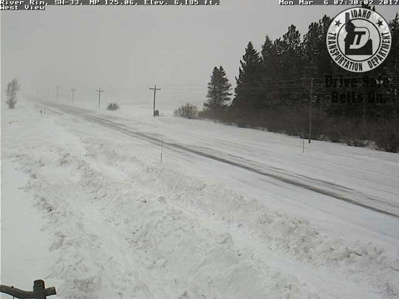
UPDATE:
Idaho Highway 31 between Swan Valley and Victor reopened at approximately 3:30 p.m.
Idaho Highway 32 between Ashton and Tetonia remains closed due to high winds and blowing and drifting snow.
It is unclear when the roads will reopen.
ORIGINAL STORY:
IDAHO FALLS — It’ll be a windy day in eastern Idaho for Monday, March 6.
The following counties remain under a high wind advisory that is set to expire at 2 p.m. Tuesday: Madison, Jefferson, Bonneville, Bingham, Bannock, Butte, Oneida, Power, Blaine and Cassia.
The National Weather Service reports strong winds of 25 to 35 mph, (with gusts up to 45 mph) will develop behind a cold front and continue through the day Monday. Winds are expected to slow down for a few hours this evening, then strengthen once more around midnight tonight.
Strong cross winds can be expected on U.S. Highway 20 and U.S. Highway 26 from Blackfoot and Idaho Falls to Arco. Also Idaho Highway 33 from Rexburg to Howe.
The Upper Valley and Teton Valley are seeing some light snow this morning that is causing slick road conditions and low visibility. Officials urge extreme caution if driving.
No road closures have been reported. However, the Idaho Transportation Department reports difficult or fair driving conditions for the following highways due to snow, slush or ice on the roadways:
- U.S. Highway 20 between Rexburg and the Montana State Line.
- Idaho Highway 33 between Sugar City and the Wyoming State Line.
- Idaho Highway 32 between Ashton and the Tetonia.
- Idaho Highway 31 between Victor and the Wyoming State Line.
- Idaho Highway 34 between Soda Springs and the Wyoming State Line.
- Idaho Highway 47 between Ashton and Warm River.
- U.S. Highway 93 between Salmon and the Montana State Line.
- U.S. Highway 89 between Montpelier and the Wyoming State Line.
- Idaho Highway 37 between Roy and the Interstate 86 junction.
- Idaho Highway 39 between American Falls and Pingree.
- Interstate 86 from Raft River to Pocatello
- Interstate 15 between Pocatello and Blackfoot
- U.S. Highway 91 between Fort Hall and Pocatello
- U.S. Highway 30 between the Interstate 86 junction and Pocatello
SEE YOUR COMPLETE EASTIDAHONEWS.COM 10-DAY FORECAST HERE
Idaho Falls and Rexburg
Bonneville, Madison and Jefferson counties will be partly sunny with a slight chance of snow Monday. Temperatures of 24 to 31 degrees are expected with winds of 20 to 30 mph during the day. At night it’ll be mostly cloudy with a 50 percent chance of snow. Temperatures will drop to between 14 to 22 degrees.
Pocatello
The Pocatello area will be party sunny Monday with a slight chance of snow in the morning and afternoon. High winds of 25 to 35 mph are expected with highs of 24 to 34 degrees. At night it will be mostly cloudy with a 40 percent chance of snow. Winds will decrease to 20 to 30 mph with lows of 19 to 26 degrees.
St. Anthony, Ashton, Island Park, Driggs, and Victor
The Upper Valley and Teton Valley will be mostly cloudy with a chance of snow all day. Up to 2 inches of snow could fall with highs of 21 to 28 degrees. Clouds and the chance of snow continue into the night with lows of 7 to 16 degrees.
Arco, Challis, and Mackay
It’ll be party sunny with a slight chance of snow in the morning and afternoon. Some 2 inches of snow could fall in the area with highs of 22 to 32 degrees. Clouds will move in at night with a continued chance of snow. Lows of 11 to 18 are expected.
Henry, Soda Springs, Downey, and Lava Hot Springs
There is a chance of snow in the morning and it is likely in the afternoon. Snow accumulation of 1 to 3 inches is possible with highs of 20 to 30 degrees. It’ll be mostly cloudy in the evening with a continued chance for snow. Lows of 17 to 24 degrees are expected with southwest winds of 30 mph after midnight.
This weather-related story is brought to you by Frontier Credit Union. At Frontier Credit Union, we believe in building a better life for our members, our communities and the great state of Idaho. Explore our solutions and start building your better life today at Frontier Credit Union.