
National Weather Service urges caution ahead of heat wave Monday and Tuesday
Published at | Updated at
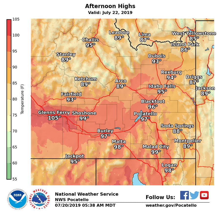
IDAHO FALLS – The National Weather Service is forecasting above average daytime temperatures over the next several days, which may pose a threat to people with prolonged exposure to the sun.
Temperatures for most of eastern Idaho are expected to be in the mid to upper 90s or approach 100 degrees. Strong high pressure will bring warmer and drier conditions across the area starting Sunday, but increase in intensity Monday and Tuesday.
Daytime temperatures across the Snake River Plain will range from 84 to 92 Sunday. Overnight temperatures will likely be mild, but a temperature increase is likely Monday with highs between 89 and 98 degrees.
Higher than normal temperatures are also expected across the eastern Magic Valley and southern highlands.
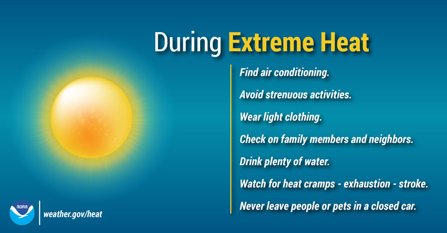
The temperature increase poses a moderate heat risk for people spending a lot of time outside. NWS is urging you to be cautious while in the outdoors. Avoid strenuous activities outdoors Monday and Tuesday. Drink plenty of water. Never leave people or pets in a closed car.
You can stay up to date on the latest conditions in your community by checking out the weather cams at EastIdahoNews.com.
This weather-related story is brought to you by Pony Express Car Wash, Idaho's premier express car wash destination, renowned for its commitment to exceptional service and quality. Voted the No. 1 car wash company in Idaho for three consecutive years, we pride ourselves on delivering an unparalleled experience for every vehicle and customer. Our state-of-the-art facility utilizes name-brand soaps and cutting-edge equipment to ensure your car receives the ultimate clean. Established in eastern Idaho in 2019, Pony Express is proud to be a locally owned and operated company that caters to the unique car washing needs of our Idaho Friends and neighbors. We invite you to experience the difference at Pony Express, where your satisfaction is our ultimate goal.