
Get ready for snow. We could see some this weekend.
Published at
IDAHO FALLS – Snow showers are headed to eastern Idaho this weekend.
The National Weather Service is forecasting light snow from 6 a.m. Friday to 6 a.m. Saturday.
The area of impact includes West Yellowstone, Driggs and Jackson all the way into the upper Snake River Plain and extending as far west as Stanley and Glenn’s Ferry and as far south as Jackpot, Nevada and Logan, Utah.
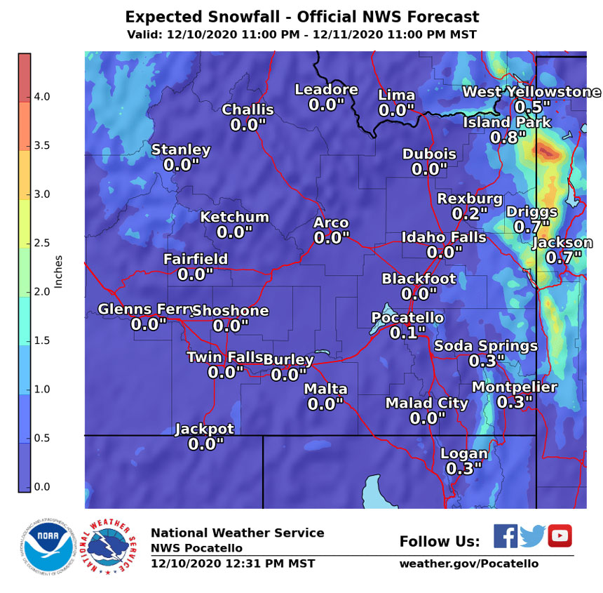
Minimal snowfall is expected across most of eastern Idaho Friday. NWS meteorologists say there will be less than an inch of snow in the areas of West Yellowstone, Island Park, Driggs, Jackson and Rexburg. Up to three-tenths of an inch is expected in Soda Springs and Pocatello.
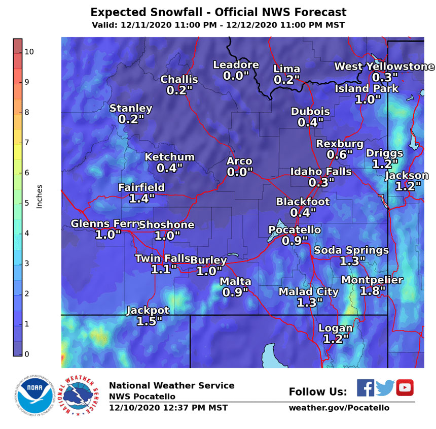
Between Friday night and Saturday night, more than an inch of accumulation is expected in the Island Park, Driggs and Jackson areas. Rexburg, Rigby, Idaho Falls and Blackfoot will see about half an inch with about an inch of snow in Pocatello. More than an inch is likely in areas farther west and south.
Looking beyond Saturday, NWS says light snow is expected every 36-48 hours through next weekend.
Get the latest weather conditions in your community on the EastIdahoNews.com weather page.
This weather-related story is brought to you by Pony Express Car Wash, Idaho's premier express car wash destination, renowned for its commitment to exceptional service and quality. Voted the No. 1 car wash company in Idaho for three consecutive years, we pride ourselves on delivering an unparalleled experience for every vehicle and customer. Our state-of-the-art facility utilizes name-brand soaps and cutting-edge equipment to ensure your car receives the ultimate clean. Established in eastern Idaho in 2019, Pony Express is proud to be a locally owned and operated company that caters to the unique car washing needs of our Idaho Friends and neighbors. We invite you to experience the difference at Pony Express, where your satisfaction is our ultimate goal.