
Winter weather advisory in effect for eastern Idaho beginning Sunday night
Published at | Updated at
IDAHO FALLS – Bundle up, because a snowstorm could impact your community this weekend.
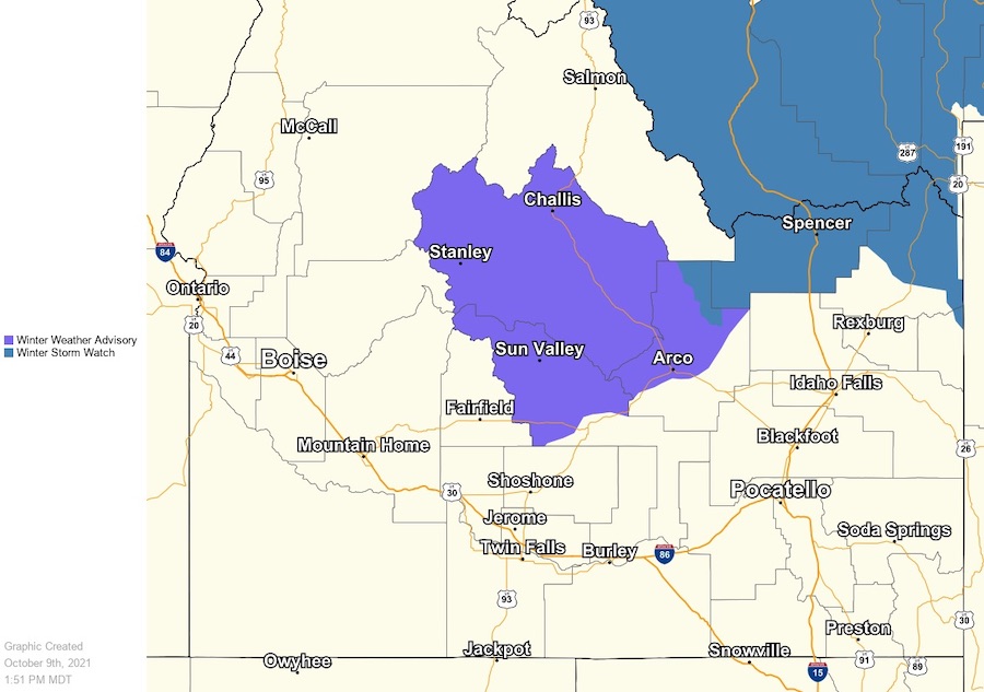
The National Weather Service in Pocatello is issuing a winter weather advisory in effect Sunday evening through Tuesday. An “upper level low” with much colder air will sweep across the region late Sunday night and will impact the areas of Island Park, Kilgore, Spencer, Edie School, Small, Monida Pass, Raynolds Pass, and Targhee Pass.
Lower elevations will see mostly rain but heavy snow is expected in the mountains.
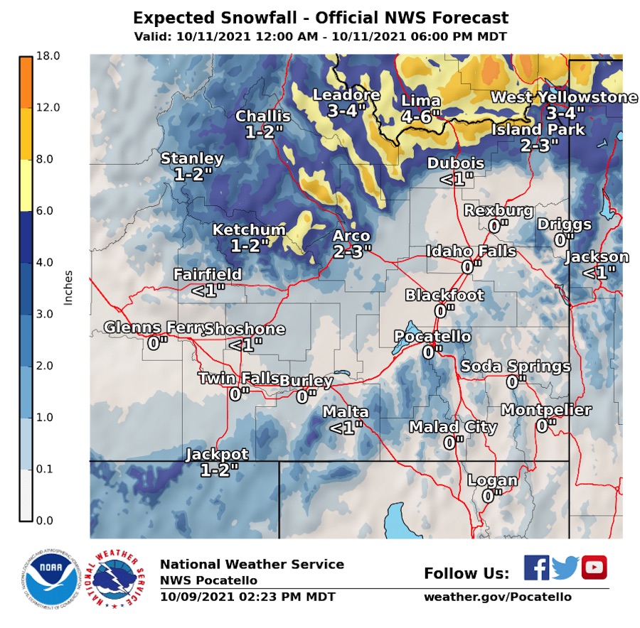
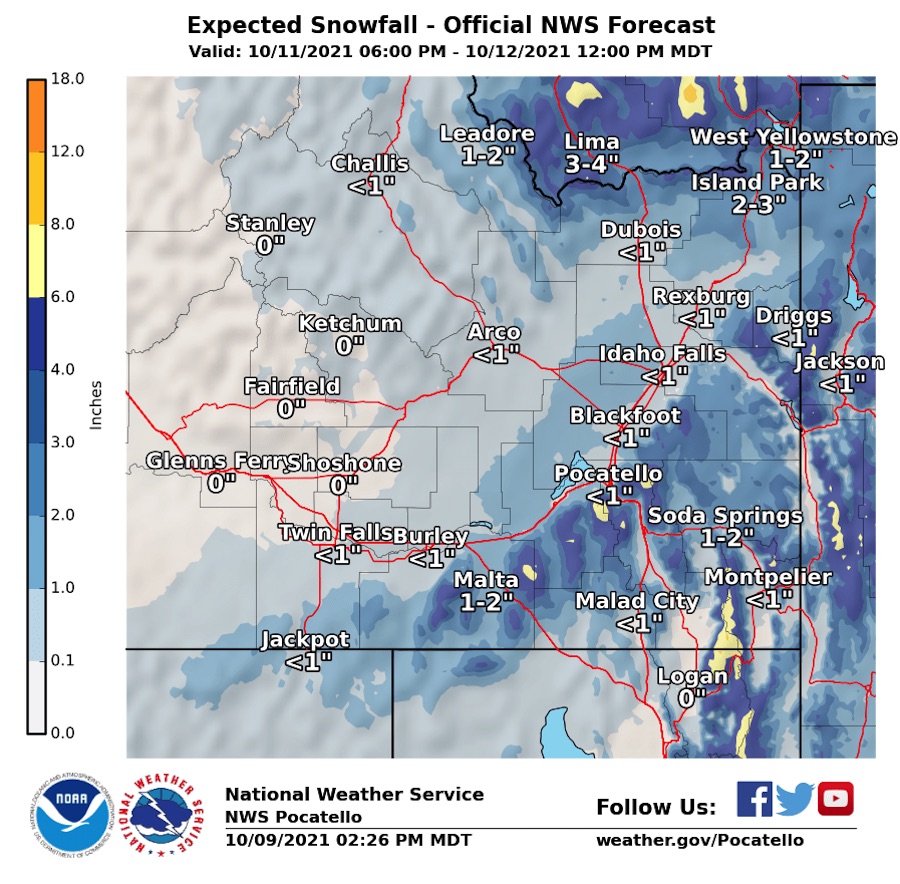
Then on Monday, most of the Snake River plain will be affected, with up to an inch of snowfall in the areas of Jackson, Driggs, Rexburg and stretching south all the way to Malad. Several inches of snow are expected in and around West Yellowstone, Island Park, Lima, Leadore and Challis.
“Central Mountains and along the Montana Divide are likely to see all snow with accumulations 6-12 inches above 6,000 feet,” meteorologists with the NWS say. “Higher elevations will see gusty winds, potentially contributing to possible blowing and drifting snow.”
Winds could gust as high as 35 mph.
Other areas of impact include Howe, Arco, Mackay, Chilly, Borah Peak, Challis, Clayton, Stanley, Ketchum, Sun Valley, Galena, Copper Basin, Hailey, Bellevue, Picabo, Galena Summit and Willow Creek Summit.
The NWS is forecasting colder temperatures throughout eastern Idaho as the week progresses.
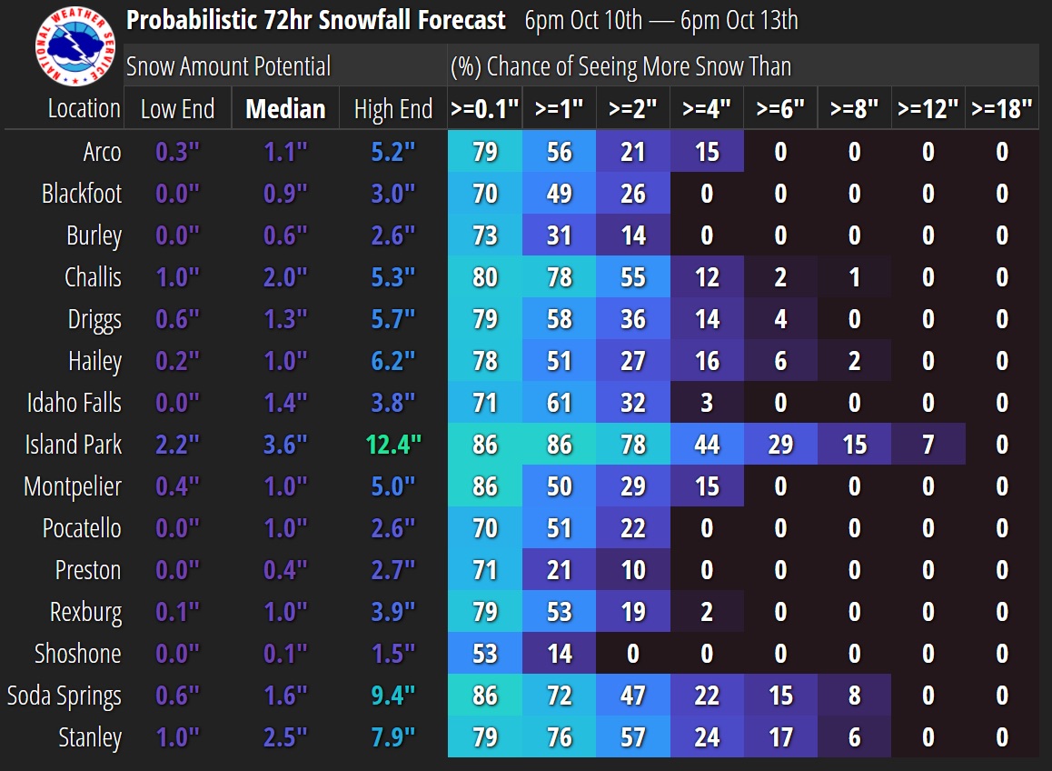
A breakdown of snowfall potential in your area is provided in the graphic below.
Visit the EastIdahoNews.com weather page for weather cams and the latest conditions where you live. Click here for the latest road conditions.
This weather-related story is brought to you by Pony Express Car Wash, Idaho's premier express car wash destination, renowned for its commitment to exceptional service and quality. Voted the No. 1 car wash company in Idaho for three consecutive years, we pride ourselves on delivering an unparalleled experience for every vehicle and customer. Our state-of-the-art facility utilizes name-brand soaps and cutting-edge equipment to ensure your car receives the ultimate clean. Established in eastern Idaho in 2019, Pony Express is proud to be a locally owned and operated company that caters to the unique car washing needs of our Idaho Friends and neighbors. We invite you to experience the difference at Pony Express, where your satisfaction is our ultimate goal.