
Temperatures to drop 20-30 degrees and snow is possible this week in eastern Idaho
Published at | Updated at
IDAHO FALLS — Bundle up! Another early-season winter storm will move into the northern Rockies Tuesday and Wednesday, bringing moderate snow, wind and a drastic 20-30 degree temperature drop as a strong cold front crosses the region Wednesday morning.
The National Weather Service reports snow accumulations Wednesday may reach 2-4 inches in the northern Central Mountains, 2-6 inches across the Upper Snake Highlands and Montana Border, and a dusting to 1.5 inches elsewhere across southeast Idaho.
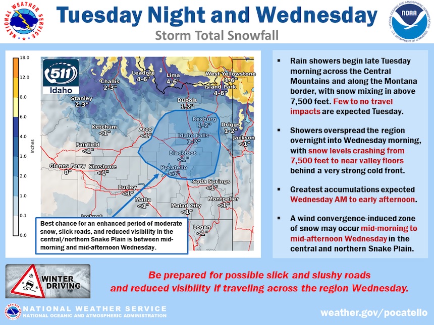
An enhanced band or zone of moderate snow, reduced visibility, and slick roads is possible in the central or northern Snake Plain from mid-morning through mid-afternoon Wednesday.
Some areas may see a flash freeze Wednesday morning as the cold air pours in, making some wet and untreated roads icy.
This weather-related story is brought to you by Pony Express Car Wash, Idaho's premier express car wash destination, renowned for its commitment to exceptional service and quality. Voted the No. 1 car wash company in Idaho for three consecutive years, we pride ourselves on delivering an unparalleled experience for every vehicle and customer. Our state-of-the-art facility utilizes name-brand soaps and cutting-edge equipment to ensure your car receives the ultimate clean. Established in eastern Idaho in 2019, Pony Express is proud to be a locally owned and operated company that caters to the unique car washing needs of our Idaho Friends and neighbors. We invite you to experience the difference at Pony Express, where your satisfaction is our ultimate goal.