



Cooler temperatures and flood watch coming this weekend, National Weather Service says
Published at | Updated at
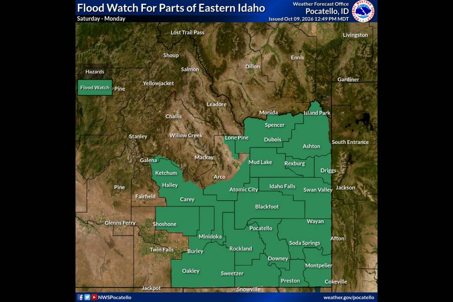
POCATELLO — The National Weather Service is saying cooler temperatures are coming to eastern Idaho this weekend, with a flood watch in effect from noon Saturday to 6 p.m. Monday.
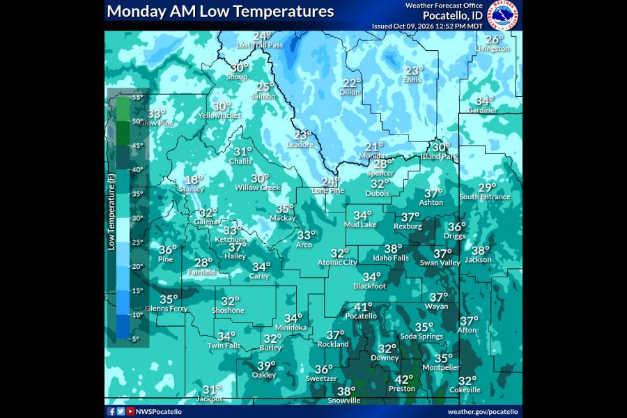
In a news release, the NWS reports that temperatures will fall from near-80°F on Friday to the mid-to-high 60s on Saturday, then into the 50s on Sunday. As early as Sunday morning, overnight and early-morning temperatures may fall to 32-36°F in parts of the eastern Magic Valley and across the desert.
In addition to the lower temperatures, the NWS is warning of a potential flood risk. Steady light-to-moderate rainfall is expected to begin Saturday afternoon and continue into Sunday and Monday. The NWS’s release states that while rainfall rates may not cause flooding, the amount may be enough to overwhelm some areas, especially burn scars.
Rainfall amounts are predicted to increase as you go east.
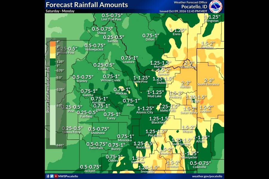
“In parts of the eastern Magic Valley and Central Mountains, current totals through Monday range from about 0.50-1.00″ with 1.00-1.50″ more likely along the 1-15 corridor, and 1.50-2.00″ throughout the Eastern Highlands,” the release says. “Locally higher amounts to almost 3.00″ are possible.”
Due to all the rain and colder temperatures, high-elevation snowfall is also in the forecast, but the NWS reports that the coldest temperatures will remain north in Montana.
This weather-related story is brought to you by Pony Express Car Wash, Idaho's premier express car wash destination, renowned for its commitment to exceptional service and quality. Voted the No. 1 car wash company in Idaho for five consecutive years, we pride ourselves on delivering an unparalleled experience for every vehicle and customer. Our state-of-the-art facility utilizes name-brand soaps and cutting-edge equipment to ensure your car receives the ultimate clean. Established in eastern Idaho in 2019, Pony Express is proud to be a locally owned and operated company that caters to the unique car washing needs of our Idaho Friends and neighbors. We invite you to experience the difference at Pony Express, where your satisfaction is our ultimate goal.