
Water supply stress ahead for east Idaho, NWS says
Published at | Updated at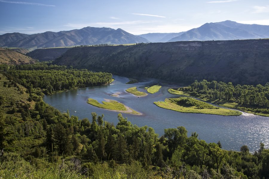
POCATELLO — After east Idaho’s warmest winter on record, regional weather experts say the forecast for the largest river system in the region is “bad news.” And the rest of the Pacific Northwest looks to be in either a similar, the same, or a worse situation.
The National Oceanic and Atmospheric Administration held a webinar last week to discuss what it called “a dire water supply situation” across not just Idaho, but also Washington and Oregon. The three states have seen record-breaking warm temperatures this winter, leading to severe, near‑record drought across most of the region.
And if next year’s conditions are like this year’s, the situation will be even worse.
“If we have another dry winter, then it gets really grim,” said Mark Dallon, hydrologist for the National Weather Service in Pocatello.
An unseasonably warm winter and spring
By the end of February, eastern Idaho had collectively seen its warmest winter ever recorded, according to the National Weather Service.
In Pocatello, the average temperature this winter was 34.9 degrees Fahrenheit, said Jack Messick, a meteorologist for the weather service in Pocatello; in Idaho Falls, it was 32.1 degrees, he said.
Comparing this year’s averages to east Idaho’s normal average temperatures — 18.2 degrees in Pocatello and 13.7 degrees in Idaho Falls — shows that Pocatello was 16.7 degrees warmer than normal this year, and Idaho Falls was 18.4 degrees warmer.
Temperatures have been unseasonably warm across the Pacific Northwest.
Idaho, Washington and Oregon combined saw the second-warmest November and the warmest December on record, which goes back over 130 years, said Jacob Genuise, engagement climatologist with the Washington State Climate Office.
“These (temperatures) are really remarkable from this really long record of … data,” Genius told those participating in the webinar.
As winter gave way to spring, temperatures did not cool or return to normal.
East Idaho also had its warmest March on record, Messick said, with an average of 46.6 degrees and 45.6 degrees in Pocatello and Idaho Falls, respectively.
He noted that these temperatures are almost 2.5 degrees and 2 degrees higher than the previous warmest March on record for the two cities. “Which is actually quite a bit (of an increase) when you look at average mean temperature,” Messick said.
The same held true across the region. Idaho, Washington and Oregon all saw temperatures in the top 10 warmest on record for January, February and March this year, Genuise said.
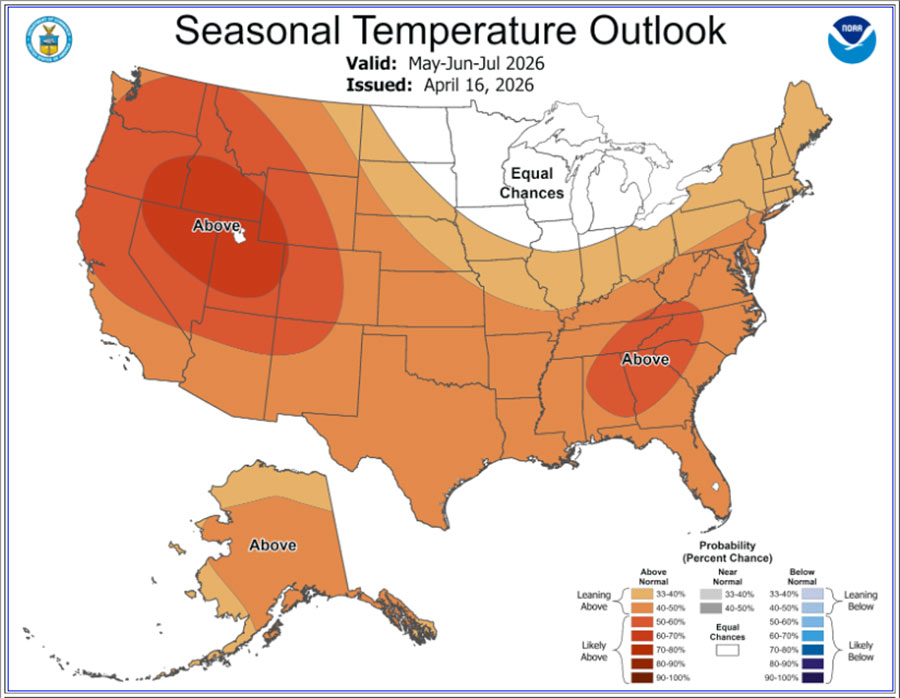
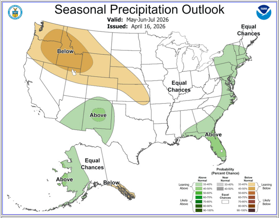
There doesn’t look to be a break in these warmer-than-normal temperatures as summer approaches.
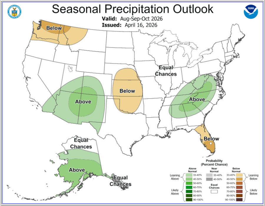
Messick said the weather service is forecasting with “solid confidence” that May, June and July will have a below-normal amount of precipitation, and with “very high confidence” that temperatures will be above normal.
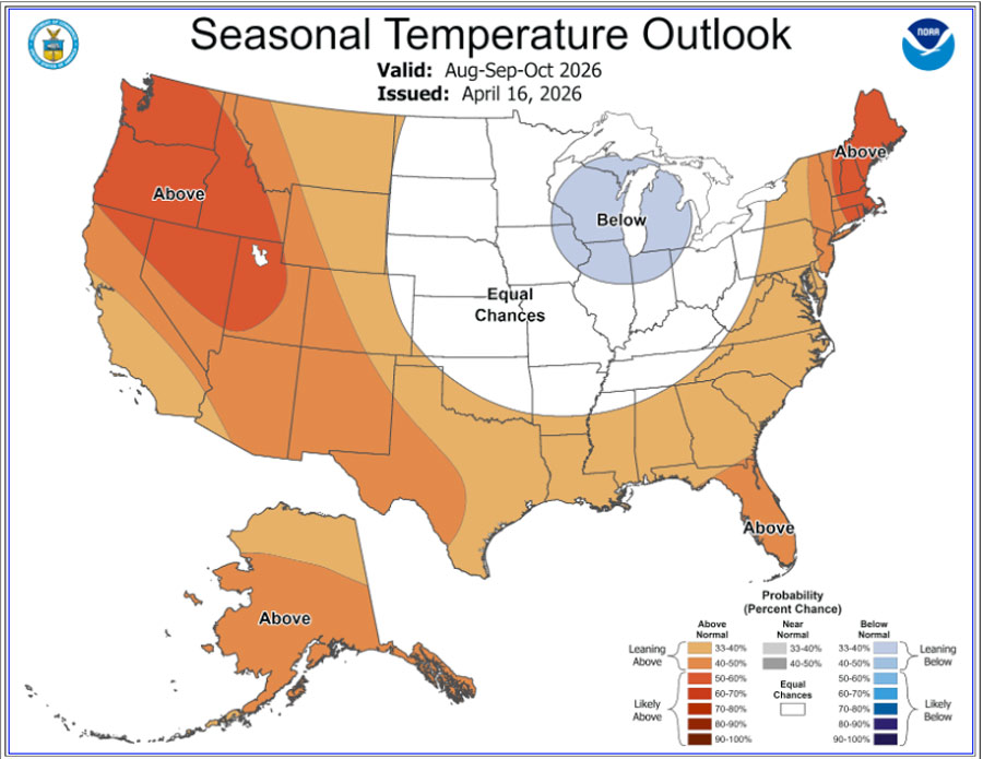
While Messick said there’s no clear indication of how much precipitation east Idaho will see going into the fall, the weather service is forecasting temperatures to remain above normal then, as well.
“There’s really no relief through the calendar year,” Messick said.
A drought driven by heat
While east Idaho and the Pacific Northwest as a whole experienced drought conditions over the winter, it wasn’t a drought driven by a lack of precipitation. Rather, meteorologists say it was driven by warm temperatures.
This drought would be more accurately described as a “snow drought,” they said. A snow drought occurs when high temperatures cause precipitation to fall as rain instead of snow, preventing places at lower elevations from building a snowpack.
“There was no snow accumulation below 7,000 feet — not of note. Like, snow sites below that level were really low,” Dallon said. “When March kicked in, everything started melting early, so even high-elevation sites started melting three to four weeks early.”
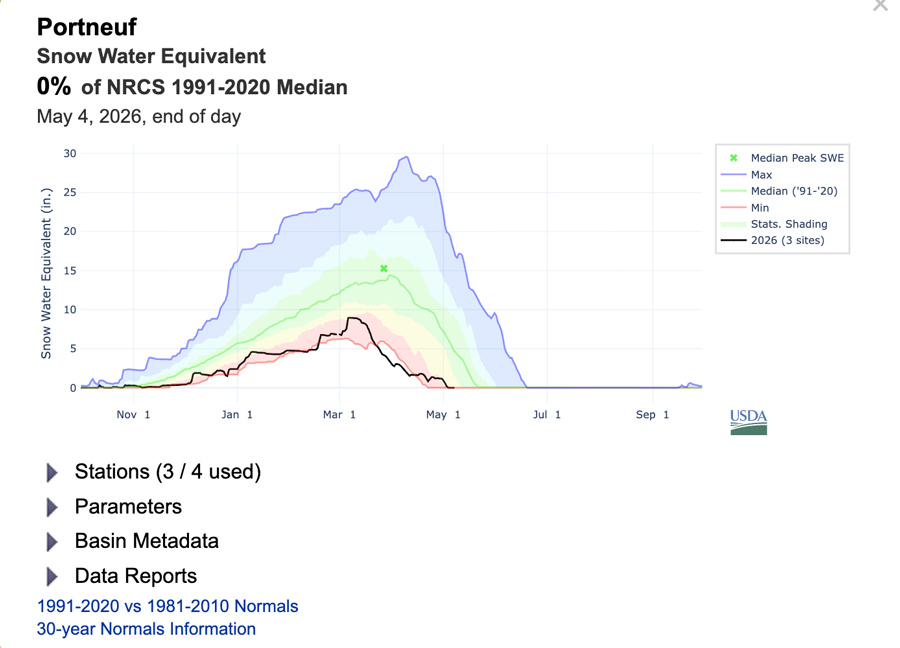
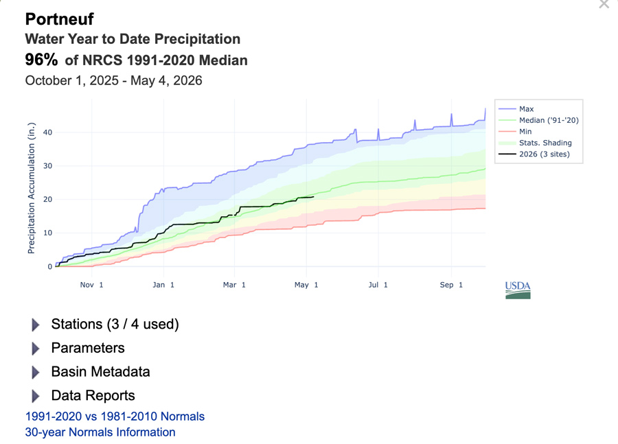
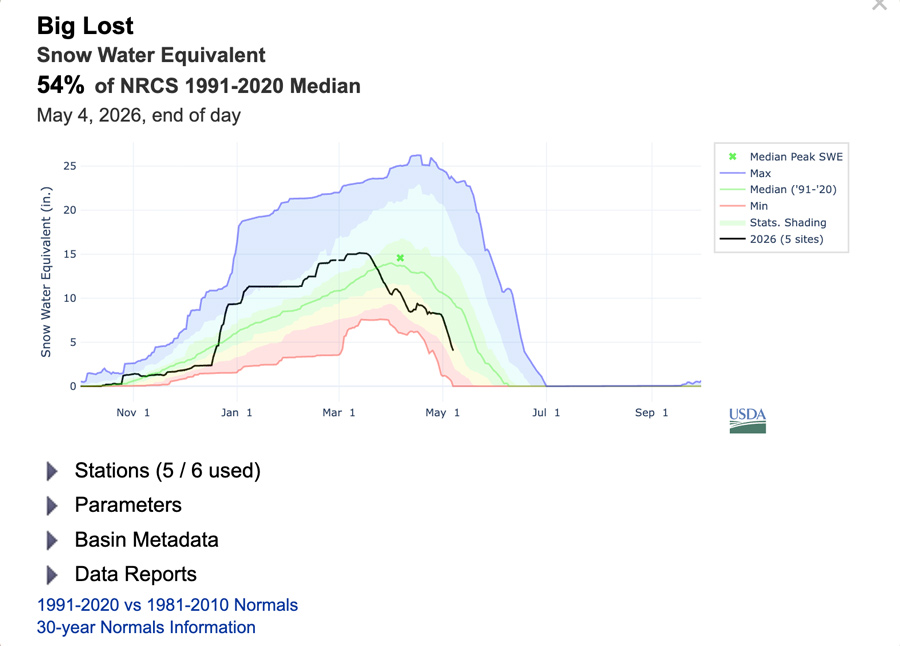
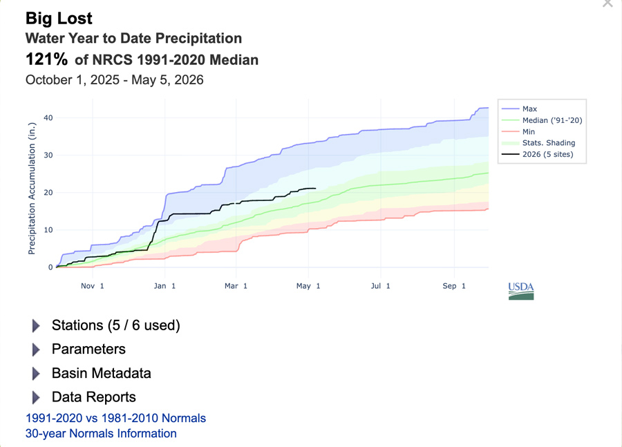
Snowpack is measured by snow water equivalent, which represents how much liquid water would result if the snowpack melted instantaneously. Both snow water equivalent and precipitation levels are measured in “percent of median,” meaning that 100% is the median.
For example, the Portneuf River Subbasin, which sits at a lower elevation, saw its snow water equivalent hover between 40% and 50% during the winter and hit its peak at the beginning of March. After that, it declined quickly. The actual precipitation levels remained close to the median during that entire period.
And at a higher elevation, the Big Lost River Subbasin built a healthy snowpack, hitting its peak above the median snow water equivalent. But then March arrived, and snow water equivalent declined sharply; it’s now sitting at 47% of the median.
An effect of early snowpack melt is that it causes reservoir water levels to peak earlier.
“The Snake River in eastern Idaho … the whole system peaked in early April, and that’s really unprecedented. And it was only about 79% of total capacity,” Dallon said.
He went on to explain that that figure represents the water levels in the Jackson Lake, Palisades and American Falls reservoirs added together. Normally, he said, the Snake River system would not peak until mid-June.
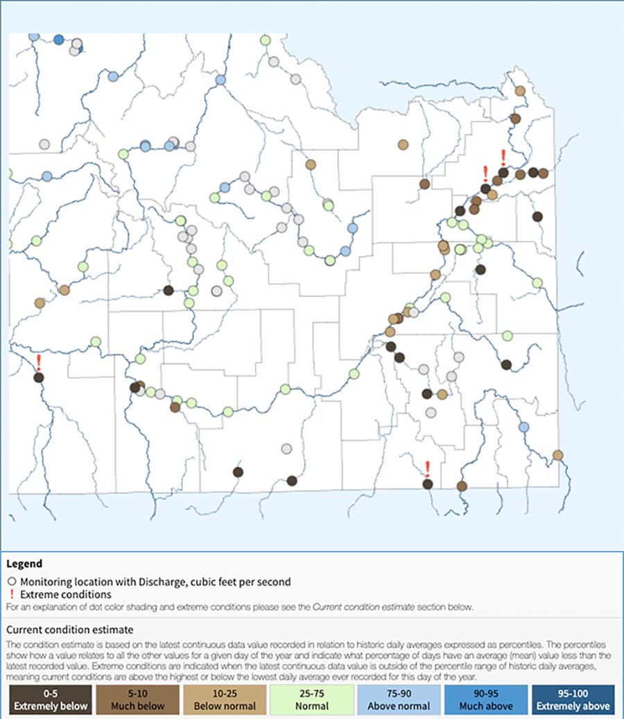
The volume of river flow in the Snake River system is at historic lows, also due to early snowmelt. Flow of the Snake River is measured on a scale from 0% to 100%, with anywhere between 25% and 75% being within a normal range.
All of the monitoring sites of the United States Geological Survey on Henry’s Fork above where it meets the South Fork of the Snake River are within the below-normal, much-below and extremely-below ranges. Two of those sites are marked as facing “extreme conditions.”
Dallon called this an “almost period of record-low.” And on top of this, forecast flows are declining, as well.
“The forecast volume flows are going down, and so that’s bad news,” Dallon said. “At the very best, reservoirs this fall are going to have horrible carryover. And so that means if we have another dry winter, then it gets really grim.”
This weather-related story is brought to you by Pony Express Car Wash, Idaho's premier express car wash destination, renowned for its commitment to exceptional service and quality. Voted the No. 1 car wash company in Idaho for three consecutive years, we pride ourselves on delivering an unparalleled experience for every vehicle and customer. Our state-of-the-art facility utilizes name-brand soaps and cutting-edge equipment to ensure your car receives the ultimate clean. Established in eastern Idaho in 2019, Pony Express is proud to be a locally owned and operated company that caters to the unique car washing needs of our Idaho Friends and neighbors. We invite you to experience the difference at Pony Express, where your satisfaction is our ultimate goal.