
Rockies and western Plains hit with heavy snow and blizzard conditions
Published at | Updated atChristina Maxouris and Haley Brink, CNN
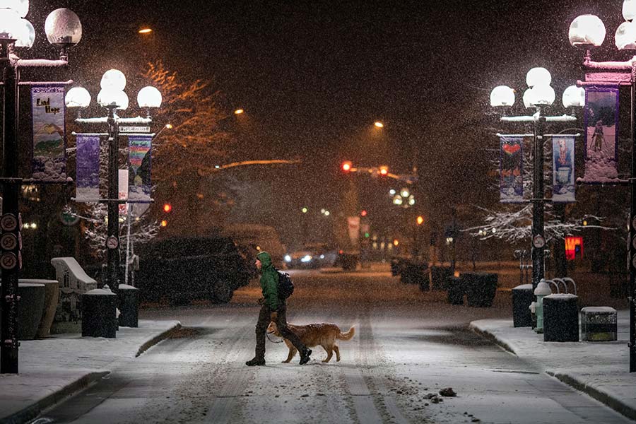
(CNN) — The Rocky Mountains and western Plains were digging out after heavy snow and blizzard conditions on Monday while people in Texas cleaned up from tornado damage.
More than 8 million Americans remain under winter weather alerts Monday morning, with just over 100,000 of them under blizzard warnings, according to CNN meteorologists.
Colorado Gov. Jared Polis’ office said Sunday that all state government offices in Denver and surrounding counties will be closed Monday because of the extreme weather conditions.
Essential state facilities for public health and safety will remain open and essential personnel will still report to work, according to a release from the office.
The snowstorm is now pushing into the Midwest, where winter weather alerts cover around 8 million people, including areas just south of Minneapolis and just west of Chicago.
As much as 6 to 8 inches of snow is forecast Monday across portions of southern Minnesota and northern Iowa, making for slow travel and potential airport delays.
Record snowfalls
There were more than 27 inches of snow reported at Denver International Airport as of Monday morning, marking Denver’s fourth-heaviest snowstorm since records were kept in 1881, CNN Meteorologist Dave Hennen said.
Denver International remained closed to flights Monday morning as crews continued to clear runways, the airport said in a tweet.
The airport has also advised people not to travel to it by vehicle due to blizzard conditions that have made Peña Boulevard, the main road to the airport, “impassable with multiple disabled vehicles along the roadways.”
Cheyenne, Wyoming, had measured 36 inches of snow by Monday morning, which sets a new two-day snowfall total. The prior record of 25.2 inches was set in November 1979. By Sunday evening another 11 inches of snow had fallen in the area.
Boulder saw about 8 to 12 inches of snow, and the town of Estes Park has had just over a foot.
The Colorado Avalanche Information Center said there is a “high” avalanche threat for the Front Range until Monday morning. Heavy and intense snowfall from the current storm will cause large and destructive avalanches at all elevation levels, above and below the tree line, and in “unusual locations,” according to the center.
Across Colorado, several major roads are also closed, including two stretches of interstates.
Southeast of Denver, the County of Elbert has declared a state of emergency due to worsening weather conditions, a tweet from the county’s public information officer said.
“Please be advised that abandoned vehicles that impede snow clearance and rescue operations may be towed or otherwise moved to allow emergency crews to ensure the safety of our citizens,” the tweet said.
Leadville, Colorado, reported more than 10 inches of snow early Sunday while the town of Sawpit also saw nearly 10 inches of snow, according to snowfall totals posted by the National Weather Service.
The snow, coupled with high winds, could mean that parts of Wyoming, Nebraska and South Dakota will see blizzard conditions, making travel in those areas next to impossible, according to Mauldin.
Uinta County, Wyoming, could see snowfall totals of 1 to 2 feet, the weather service from Salt Lake City projected. As of Sunday evening, there had been 6 inches in the lower elevations of the county and just over 13 inches in the mountains.
A winter storm warning for the western Uinta Mountains and Uinta County, Wyoming, has been lifted.
Southeast could see flood concerns
Meanwhile, flood watches and warnings were in effect for areas of Kansas and Missouri, while heavy rain was impacting parts of Nebraska and Iowa.
“Be on lookout for localized flooding of typical flood-prone areas,” the weather service in Wichita, Kansas, wrote on Twitter.
As the storm system moves east over the next day or two, the Southeast could also face flood concerns.
Parts of Alabama and Georgia could see between 2 and 4 inches of rain Monday and Tuesday.
The weather service in Atlanta warned “multiple rounds” of rain and storms were expected Monday through Thursday with rainfall totals hitting 2-3 inches.
Tornado damage reported in Texas
In Texas, Randall County Sheriff Christopher Forbis warned Saturday evening of multiple downed power lines and baseball-sized hail soon after the National Weather Service in Amarillo reported two simultaneous tornadoes in the area.
Saturday night, the sheriff said parts of the county had seen “extensive tornado damage” but no injuries had been reported.
There were 40 preliminary severe storm reports on Saturday, 11 of which were tornadoes, according to Mauldin.
Severe weather threats shifted to Arkansas on Sunday, where showers and strong thunderstorms were forecast throughout the afternoon and evening, according to the National Weather Service in Little Rock.
This weather-related story is brought to you by Pony Express Car Wash, Idaho's premier express car wash destination, renowned for its commitment to exceptional service and quality. Voted the No. 1 car wash company in Idaho for three consecutive years, we pride ourselves on delivering an unparalleled experience for every vehicle and customer. Our state-of-the-art facility utilizes name-brand soaps and cutting-edge equipment to ensure your car receives the ultimate clean. Established in eastern Idaho in 2019, Pony Express is proud to be a locally owned and operated company that caters to the unique car washing needs of our Idaho Friends and neighbors. We invite you to experience the difference at Pony Express, where your satisfaction is our ultimate goal.