
Pending snow, freezing temperatures may cause hazardous road conditions
Published at | Updated at
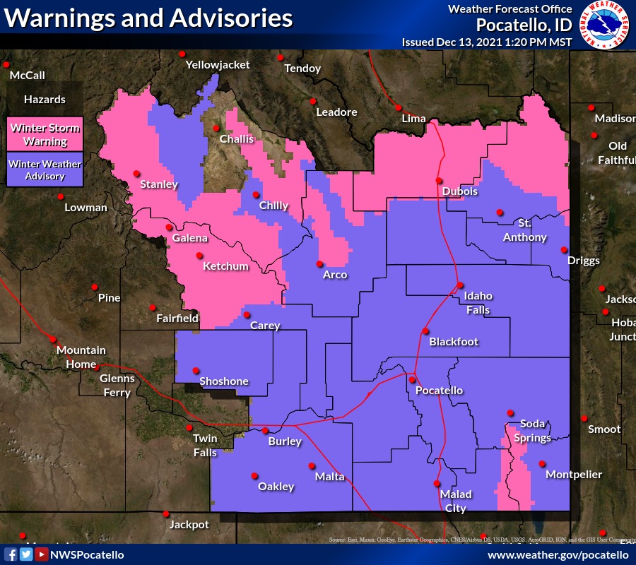
POCATELLO — The National Weather Service in Pocatello reports an ongoing winter storm could make driving conditions hazardous.
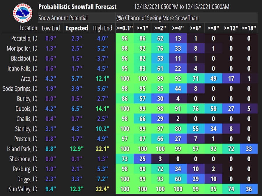
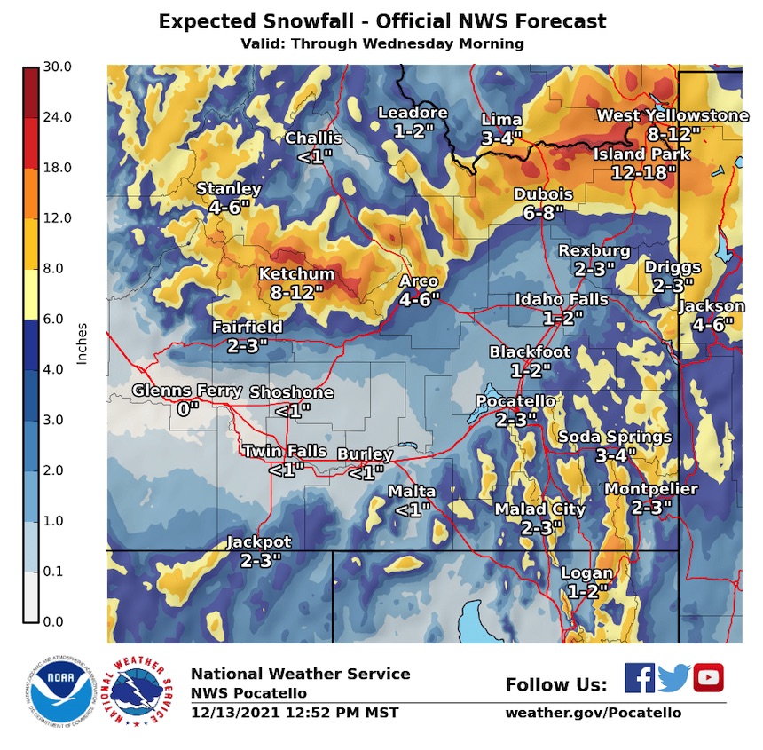
NWS is forecasting between one and three inches of snow in the lower elevations across eastern Idaho. Snowfall is expected to begin Tuesday afternoon and into Wednesday morning as far west as Burley.
As a cold front moves into eastern Idaho Tuesday, temperatures could drop quickly to below freezing. With rain or snow potentially already on the roads, the sudden drop in temperature could flash freeze wet roads.
“The potential of water freezing on roadways with snow falling on top of it could create hazardous driving conditions,” the NWS said in a news release.
Idaho State Police Lt. Chris Weadick tells EastIdahoNews.com with the potential for slick roads, drivers need to slow down, open up their following distance and drive defensively. Weadick says people also need to put down their phones and wear their seatbelts to keep themselves and others safe.
“Be a part of the solution and not part of the problem,” Weadick says. “If (the roads) are icy and snow-covered, you gotta reduce your speed significantly.”
While the lower elevations face potentially dangerous road conditions, the snowfall isn’t going to stop in the upper elevations of Island Park, Victor and Driggs. From Monday afternoon through Wednesday morning, the NWS predicts another 12 to 18 inches of snowfall. Victor and Driggs could see anywhere from two to four inches.
Significant snowfall is also expected in the Sun Valley, Sawtooth and Lost River areas. In the Central Mountains, the NWS says Sun Valley could see anywhere from eight to 12 inches of snow.
For the latest weather conditions visit the EastIdahoNews.com weather page.
This weather-related story is brought to you by Pony Express Car Wash, Idaho's premier express car wash destination, renowned for its commitment to exceptional service and quality. Voted the No. 1 car wash company in Idaho for three consecutive years, we pride ourselves on delivering an unparalleled experience for every vehicle and customer. Our state-of-the-art facility utilizes name-brand soaps and cutting-edge equipment to ensure your car receives the ultimate clean. Established in eastern Idaho in 2019, Pony Express is proud to be a locally owned and operated company that caters to the unique car washing needs of our Idaho Friends and neighbors. We invite you to experience the difference at Pony Express, where your satisfaction is our ultimate goal.