
‘Gusty erratic winds,’ scattered showers, and thunderstorms expected in eastern Idaho
Published at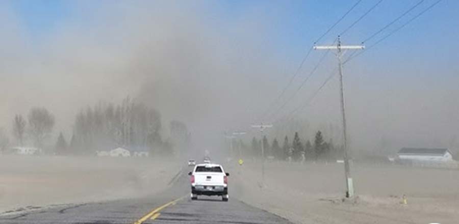
IDAHO FALLS — Windy conditions and heavy rain are expected in eastern Idaho this weekend, according to the National Weather Service in Pocatello.
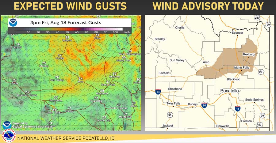
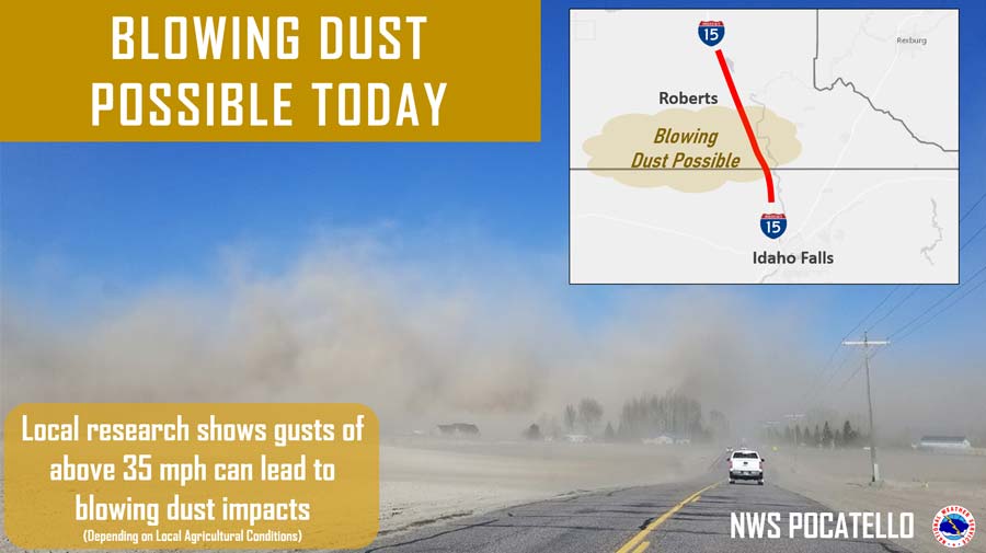
Strong winds are expected through the Snake Plain on Friday, which could lead to blowing dust along Interstate 15 north of Idaho Falls through the Roberts area, a news release from NWS said.
The winds could be anywhere from 20 to 25 mph, with gusts up to 40 mph. A wind advisory has been issued from noon to 8 p.m.
Additionally, isolated to scattered showers and thunderstorms on Friday and Saturday could bring rain, leading to localized flash flooding and “gusty erratic winds.”
“We’ve already seen some flash flooding occur Thursday night with nearly-stationary thunderstorms that developed in Chubbuck and American Falls,” NWS wrote in the release.
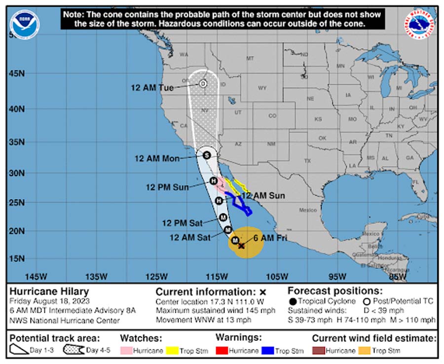
NWS said heavier rain will move into central and eastern Idaho Sunday morning as Hurricane Hilary approaches the California and Mexico coastline.
According to the Associated Press, “Hurricane Hilary grew rapidly to Category 4 strength off Mexico’s Pacific coast on Friday and could reach Southern California as the first tropical storm there in 84 years, causing “significant and rare impacts” including extensive flooding.”
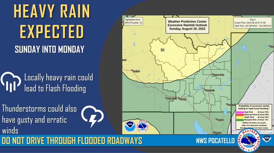
Moderate to heavy rain will continue into at least Monday as the remnants of Hilary move north towards the Idaho/Oregon state line.
“There is high confidence of moderate to heavy rain bringing the potential for localized flooding, rockslide or mudslide issues Sunday and Monday, particularly in the central mountains of Idaho,” NWS wrote.
Click here to check weather updates in your area.
This weather-related story is brought to you by Pony Express Car Wash, Idaho's premier express car wash destination, renowned for its commitment to exceptional service and quality. Voted the No. 1 car wash company in Idaho for three consecutive years, we pride ourselves on delivering an unparalleled experience for every vehicle and customer. Our state-of-the-art facility utilizes name-brand soaps and cutting-edge equipment to ensure your car receives the ultimate clean. Established in eastern Idaho in 2019, Pony Express is proud to be a locally owned and operated company that caters to the unique car washing needs of our Idaho Friends and neighbors. We invite you to experience the difference at Pony Express, where your satisfaction is our ultimate goal.