
Strong windstorm forecast for Thursday
Published at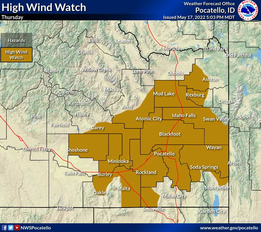
IDAHO FALLS — A cold front will bring colder temperatures and very strong winds Thursday.
The National Weather Service has issued a High Wind Watch from Thursday morning through Thursday evening.
The watch is in effect for the following cities: Idaho Falls, Rexburg, and St. Anthony, Rigby, Pocatello, Blackfoot, American Falls, Shelley, and Fort Hall, Mud Lake, INL, Craters of the Moon National Monument, Shoshone, Richfield, Carey, Burley, Rupert, Heyburn, Oakley, Malta, Rockland, Holbrook, Inkom, McCammon, Downey, Lava Hot Springs, Grace, Soda Springs, Henry, Bone, Wayan and Swan Valley.
West winds of 25 to 40 mph are predicted with gusts around 50 to 55 mph likely.
Weather officials warn that damaging winds could blow down trees and power lines. Widespread power outages are possible. Blowing dust is also possible. Travel could be difficult, especially for high-profile vehicles.
For a complete forecast visit the EastIdahoNews.com weather page.
For the latest road conditions visit 511 Idaho.
This weather-related story is brought to you by Pony Express Car Wash, Idaho's premier express car wash destination, renowned for its commitment to exceptional service and quality. Voted the No. 1 car wash company in Idaho for three consecutive years, we pride ourselves on delivering an unparalleled experience for every vehicle and customer. Our state-of-the-art facility utilizes name-brand soaps and cutting-edge equipment to ensure your car receives the ultimate clean. Established in eastern Idaho in 2019, Pony Express is proud to be a locally owned and operated company that caters to the unique car washing needs of our Idaho Friends and neighbors. We invite you to experience the difference at Pony Express, where your satisfaction is our ultimate goal.