
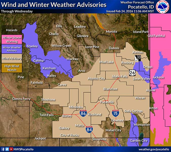
Winter weather, wind advisories in effect for eastern Idaho through Wednesday night
Published at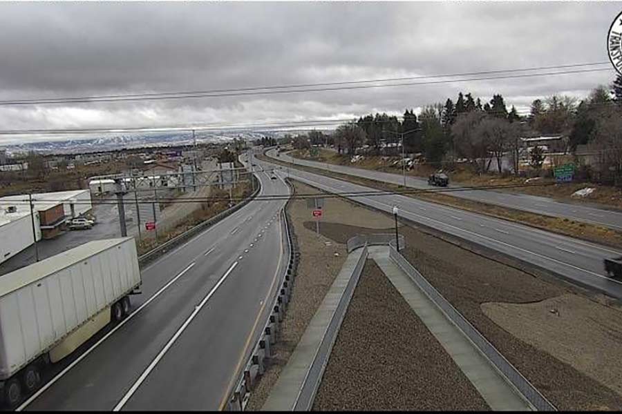
IDAHO FALLS — Amid the rainy conditions throughout eastern Idaho Tuesday, the National Weather Service in Pocatello is issuing a winter weather and wind advisory.
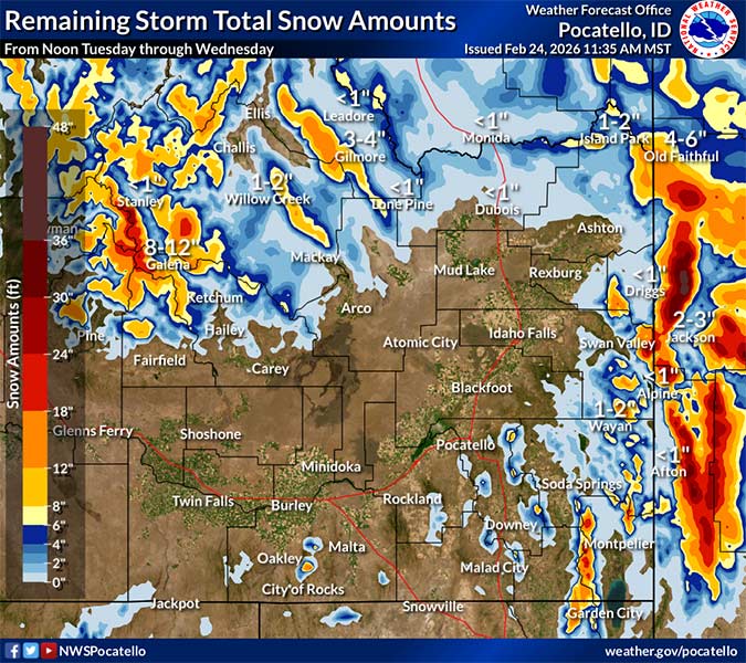
The winter weather advisory is in effect until Wednesday at 5 p.m. and will include “impactful snow above 7,000 feet.”
“This warm winter storm will continue to produce mostly rain below about 7,000 feet in elevation,” the NWS says in a Tuesday morning weather brief. “Above this level, impactful snow will likely cause travel impacts for several mountain passes throughout eastern Idaho.”
RELATED | Wet and windy conditions headed through east Idaho this week
The primary areas where snow is likely are the Sawtooth/Stanley Basin and Sun Valley, along with the Big Lost Highlands, Big Hole Mountains and the Bear River range.
Some of the main mountain passes, like Galena Summit, Pine Creek Pass and Emigration Summit, could get anywhere from eight to 12 inches of snow during this time.
“Temperatures (Tuesday) evening will continue to support snow in the mountains and rain below about 7,000 feet as the cold front won’t come through the area until Wednesday,” the NWS reports. “By the time snow levels drop to below 7,000 feet Wednesday, most of the moisture will be moving out of the Snake Plain and Eastern Highlands.”
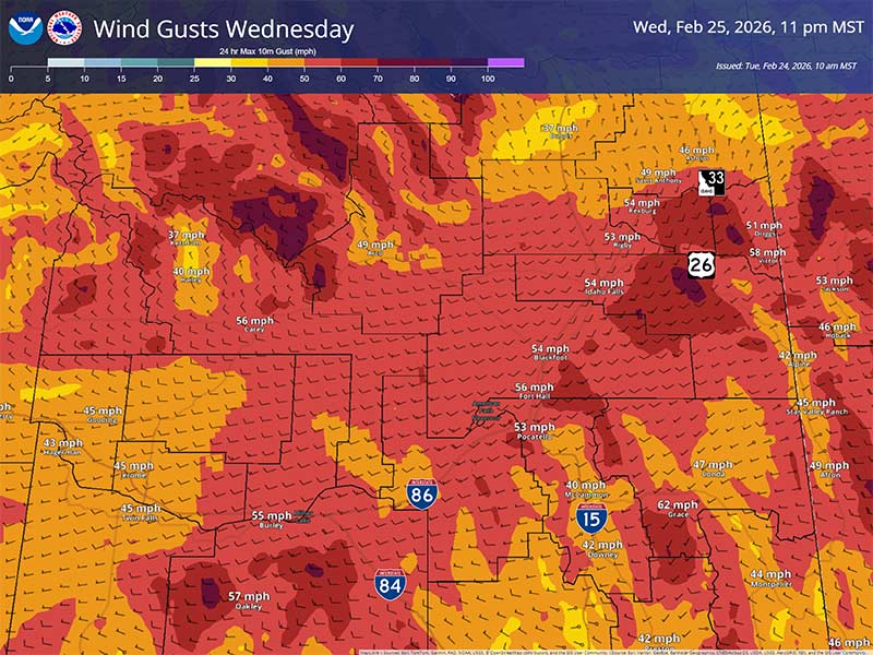
The wind advisory will remain in effect until 7 p.m. Wednesday with gusts up to 60 mph, depending on the location.
Windy conditions are expected to increase Tuesday night and into Wednesday. The strongest wind gusts will arrive Wednesday afternoon between noon and 4 p.m.
Forecasters say most of the area will see wind gusts between 40 and 55 mph. Wind prone areas may experience gusts higher than 60 mph. Areas where 60 mph winds are likely include Interstate 84 from the Utah border to the I-86 interchange in Pocatello. U.S. Highway 26 from Ririe to Swan Valley, as well as Idaho Highway 33 from Newdale towards Tetonia is a prime area for wind as well.
“Most of the strongest winds will be across the lower terrain (below 7,000 feet), but the combination of strong winds and fresh snow across the higher terrain could lead to blowing and drifting snow, particularly near the mountain passes,” the NWS brief says.
Additional information is in the graphics below.
For the latest road conditions and closures, visit the Idaho Transportation Department’s Idaho 511 website. Live weather cams and a complete seven-day forecast in your area are available here.
This weather-related story is brought to you by Pony Express Car Wash, Idaho's premier express car wash destination, renowned for its commitment to exceptional service and quality. Voted the No. 1 car wash company in Idaho for three consecutive years, we pride ourselves on delivering an unparalleled experience for every vehicle and customer. Our state-of-the-art facility utilizes name-brand soaps and cutting-edge equipment to ensure your car receives the ultimate clean. Established in eastern Idaho in 2019, Pony Express is proud to be a locally owned and operated company that caters to the unique car washing needs of our Idaho Friends and neighbors. We invite you to experience the difference at Pony Express, where your satisfaction is our ultimate goal.