
Another round of snow in the forecast for parts of eastern Idaho
Published at | Updated at
IDAHO FALLS – The National Weather Service in Pocatello is predicting another round of “heavy mountain snow” in eastern Idaho.
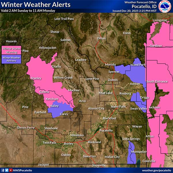
In a weather brief sent to EastIdahoNews.com Saturday afternoon, the NWS says snow is expected early Sunday through Monday morning. A winter storm warning is in effect beginning Sunday at 2 a.m. for the Sawtooth, Stanley Basin area. It will remain in effect until 11 a.m. Monday.
In eastern Idaho, a winter weather advisory is in effect for the same time for Island Park, Victor, Kilgore and surrounding communities.
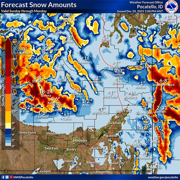
The wave of Pacific moisture is expected to bring between half an inch to an inch of snow in the Snake River Plain.
“Ample moisture for the eastern Magic Valley and Snake River Plain … with snow levels for this area around 6,000 ft early Sunday AM and rising throughout the day,” the NWS says. “Total precipitation here… will generally fall as rain. Some higher elevations will exceed 1.5 inches of liquid equivalent precipitation. Snow amounts increase rapidly as you go up in elevation with the main impacts for travelers going over mountain passes.”
Mild temperatures will continue. Meteorologists say wind gusts will increase Sunday night and into Monday night, but will remain “below advisory levels.” Gusts will range from 20-30 mph.
Those living within the area of impact are encouraged to slow down and use caution while traveling.
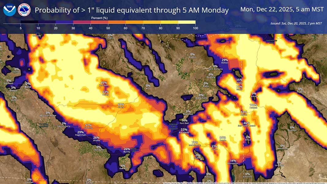
Additional information is in the graphics below.
For the latest conditions in your area, click here. The latest road conditions and closures are available here.


This weather-related story is brought to you by Pony Express Car Wash, Idaho's premier express car wash destination, renowned for its commitment to exceptional service and quality. Voted the No. 1 car wash company in Idaho for three consecutive years, we pride ourselves on delivering an unparalleled experience for every vehicle and customer. Our state-of-the-art facility utilizes name-brand soaps and cutting-edge equipment to ensure your car receives the ultimate clean. Established in eastern Idaho in 2019, Pony Express is proud to be a locally owned and operated company that caters to the unique car washing needs of our Idaho Friends and neighbors. We invite you to experience the difference at Pony Express, where your satisfaction is our ultimate goal.