
Another round of snow forecasted for eastern Idaho Tuesday night, Wednesday
Published at
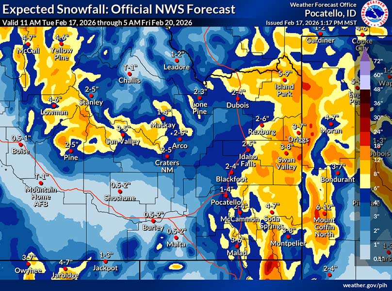
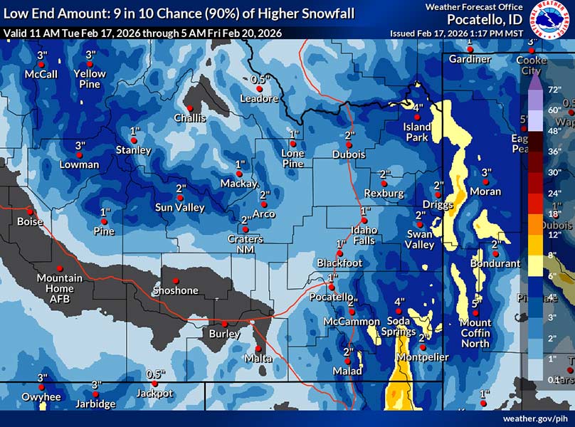
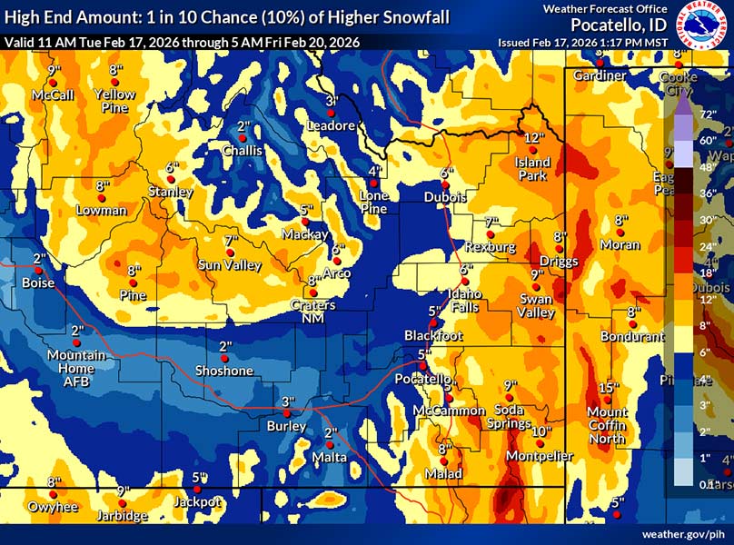
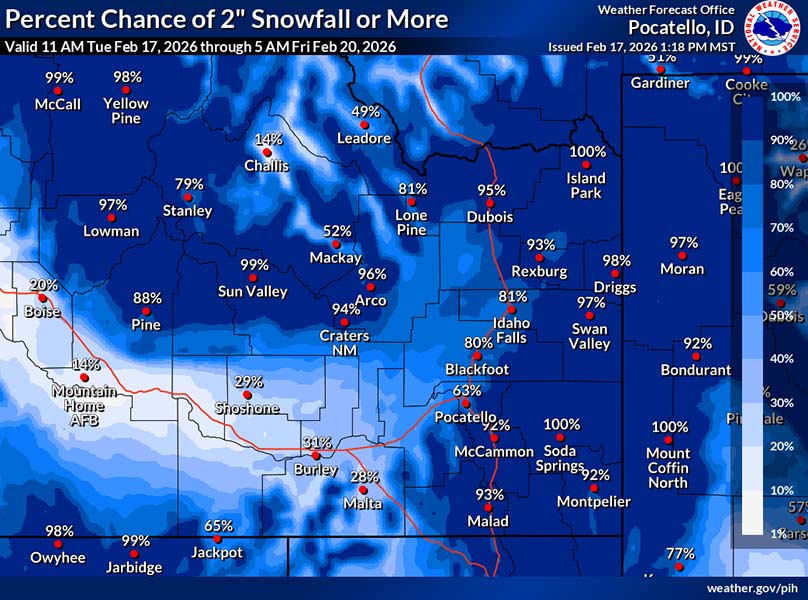
IDAHO FALLS – The National Weather Service in Pocatello is forecasting another round of snow for eastern Idaho Tuesday night.
A winter weather advisory is in effect for the Snake River Plain after 5 p.m. Tuesday and continuing through Thursday at 5 a.m. A winter storm warning is also in effect for the Bear River Mountain range during the same time period.
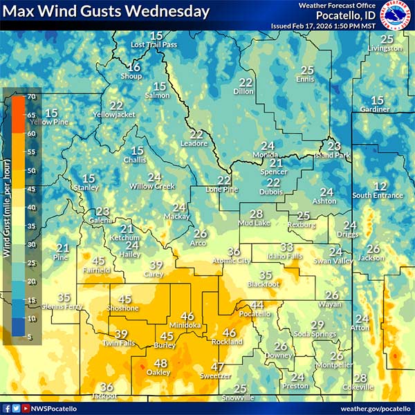
In a Tuesday afternoon weather briefing, the NWS says the winter storm will include snowfall and wind gusts up to 50 mph, resulting in drifting that will make travel difficult in some locations.
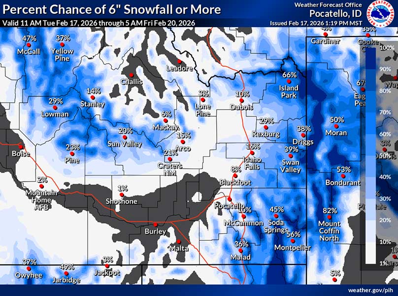
“The primary north-south oriented band of snow looks to move through the Eastern Magic Valley by about 2 a.m. (Wednesday), moving east into the Pocatello to Idaho Falls area by 4 a.m. or 5 a.m., impacting the morning commute,” forecasters say. “By sunrise, most locations east of Interstate 15 should begin to see accumulating snow, with the mountains and passes favored to see moderate to heavy rates.”
Communities east of I-15 and north of Ashton and Dubois will receive snowfall of two to eight inches. An additional four to eight inches is expected in the Central Mountains.
“A smaller confined area of high snowfall could develop Wednesday afternoon or evening,” says the NWS. “The bulk of the snow in the east (will) taper off by 5 a.m. Thursday, with light snow showers on and off through Friday.”
Although wind gusts are expected to dissipate Tuesday night, forecasters say they will pick up with the next wave of snow on Wednesday.
The strongest winds could get as high as 50 mph and extend across the South Hills, Raft River, Eastern Magic Valley and Lower Snake Plain.
RELATED | One person airlifted to hospital after semitruck vs. car crash near Tetonia
RELATED | Semitruck blocking lanes after jackknifing on winter roads
RELATED | WATCH: New info about Thursday’s multi-vehicle crash near McCammon
RELATED | WATCH: Dashcam footage shows harrowing rollover crash that hospitalized one
RELATED | Roads reopened after winter weather closures
The recent wave of snow has led to multiple crashes throughout eastern Idaho, road closures and one school closure. The latest road conditions and closures are listed on the Idaho Transportation Department’s Idaho 511 website. Live traffic cams and current conditions where you live are available here.
This weather-related story is brought to you by Pony Express Car Wash, Idaho's premier express car wash destination, renowned for its commitment to exceptional service and quality. Voted the No. 1 car wash company in Idaho for three consecutive years, we pride ourselves on delivering an unparalleled experience for every vehicle and customer. Our state-of-the-art facility utilizes name-brand soaps and cutting-edge equipment to ensure your car receives the ultimate clean. Established in eastern Idaho in 2019, Pony Express is proud to be a locally owned and operated company that caters to the unique car washing needs of our Idaho Friends and neighbors. We invite you to experience the difference at Pony Express, where your satisfaction is our ultimate goal.